| Cuyamaca 2001 | ANIMATED MAP |
Cuyamaca Project: Hike all 100+ miles of trails in Rancho Cuyamaca State Park during the summer of 2001.
Hiked Trails thru end of summer | Unhiked Trails at end of summer |
| Lake Cuyamaca - Kelly Ditch - William Heise County Park
Trailhead: Trout Pond 10.7 on Hwy 79 Hiked around Lake to Kelly Ditch trailhead; 1.5 miles Hiked along Kelly Ditch, an old, not-currently-used collection ditch for Lake Cuyamaca, until trail goes up; 2.5 miles Climbed to Horse drinking spring at Engineer Road; 3 miles Climbed to large fern meadow; 4 miles Hit high point, a North Peak sub-peak; 4.5 miles Hiked down to north end of Rancho Cuyamaca Park; 6 miles Turned around and returned same way | ||||||||||||||||||||||||||||||||||||||||||||||||||||||||||||||||||||||||||||||||||||||||
| Lake Cuyamaca - Kelly Ditch - Fern Meadow - Engineer Road
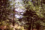
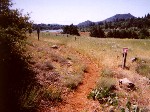
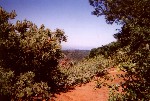
Trailhead: Trout Pond 10.7 on Hwy 79 This hike repeated part of first one, in order to obtain pictures. Hiked around Lake to Kelly Ditch trailhead; 1.5 miles
| ||||||||||||||||||||||||||||||||||||||||||||||||||||||||||||||||||||||||||||||||||||||||
| Lake Cuyamaca - Kelly Ditch - Fern Meadow
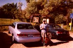
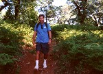
Trailhead: Trout Pond 10.7 on Hwy 79 Showed Paco this trail, and got some pix with people in it for a change. Hiked around Lake to Kelly Ditch trailhead; 1.5 miles
| ||||||||||||||||||||||||||||||||||||||||||||||||||||||||||||||||||||||||||||||||||||||||
| Hwy 79 - Oakzanita Peak - East Mesa
Trailhead: East Mesa or Oakzanita 3.7 on Hwy 79 Climbed East Mesa Fire Road to Upper Descanso Creek Trail; 0.5 miles Climbed to East Mesa; 2 miles Climbed spur trail to peak; 2.5 miles
Hiked connector trail to East Mesa Fire Road; 4.5 miles Descended Fire Road to trailhead | ||||||||||||||||||||||||||||||||||||||||||||||||||||||||||||||||||||||||||||||||||||||||
| Lake Cuyamaca - Azalea Glen - Cuyamaca Peak - Conejos
Trailhead: Trout Pond 10.7 on Hwy 79 Hiked to Los Caballos; 1 mile Hiked over to Azalea Glen Trail, ascending up to Azalea Spring; 3 miles
Hiked to Lookout Peak, close to campground; 4 miles Climbed up to Cuyamaca Peak; 6 miles Headed over towards Jamacha, but looped back on Conejos, to the CR&H; 9 miles Hiked to Milk Ranch Pass; 10 miles Finished at Trout Pond | ||||||||||||||||||||||||||||||||||||||||||||||||||||||||||||||||||||||||||||||||||||||||
| Cold Spring - Picacho - Jamacha
Trailhead: Trout Pond 10.7 on Hwy 79 Climbed Cold Stream Trail to Picacho; 1.5 miles Climbed Lookout Road to Conejos Trail; 3.5 miles Took Conejos to Burnt Pine Fire Road; 4 miles After passing Jamacha Peak; 6 miles rushed down to Cold Spring, doing last 5 miles in 1 hour | ||||||||||||||||||||||||||||||||||||||||||||||||||||||||||||||||||||||||||||||||||||||||
| Lake Cuyamaca - Cuyamaca Peak - Stonewall Peak
Trailhead: Trout Pond 10.7 on Hwy 79 Climbed Milk Ranch Road to the pass; 2 miles Hiked to Conejos Trail; 3 miles Climbed Conejos to Lookout Road; 5 miles Climbed to Peak; 5.5 miles Descended Lookout Road to Picacho; 8 miles Climbed Stonewall Peak; 10 miles
| ||||||||||||||||||||||||||||||||||||||||||||||||||||||||||||||||||||||||||||||||||||||||
| Lake Cuyamaca - Green Valley Campground - Dyar Spring Loop
Trailhead: Trout Pond 10.7 on Hwy 79 Hiked to Los Caballos; 1 mile Continued to Picacho on east side of 79, cross street to Lookout Road to West Side Trail; 2.5 miles Descended West Side Trail to Green Valley Campground, look around for continuing trails, but failed; 9 miles Walk around campground, return to Sweetwater Bridge; 10 miles Climbed Harvey Moore Trail to Dyar turnoff; 12 miles
Go by Dyar Spring down to East Side Trail; 15 miles Cross over to School Camp, connect with Cold Stream Trail, take this to Los Caballos; 19 miles Finish up at Trout Pond. | ||||||||||||||||||||||||||||||||||||||||||||||||||||||||||||||||||||||||||||||||||||||||
| Lake Cuyamaca - Stonewall Mine - PCT
Trailhead: Trout Pond 10.7 on Hwy 79 Hiked around lake to east trail up to Stonewall Mine. Made 2 loops around mine, visited little museum there; 2 miles
Continued to R&H trail, took that to highway S-1; 5 miles Crossed highway and continued to Anza Borrego State Park, crossing PCT; 7 miles Doubled back to near Stonewall Mine; 12 miles Proceeded to Los Vaqueros, then took shortest trail back to trailhead. | ||||||||||||||||||||||||||||||||||||||||||||||||||||||||||||||||||||||||||||||||||||||||
| Lake Cuyamaca - Middle Peak far side - Milk Ranch
Trailhead: Trout Pond 10.7 on Hwy 79 Hiked to north part of lake; 1 mile Turned up the Middle Peak Fire Road, following all the way to Milk Ranch Road; 8 miles
Went to end of Milk Ranch Road, peering into the Milk Ranch, a verdant paradise; 8.5 miles Took Milk Ranch Road all the way back to trailhead. | ||||||||||||||||||||||||||||||||||||||||||||||||||||||||||||||||||||||||||||||||||||||||
| Lake Cuyamaca - Middle Peak Black Oak Trail - Azalea Glen
Trailhead: Trout Pond 10.7 on Hwy 79 Hiked over to Middle Peak Fire Road; 1 mile Climbed to near peak; 3 miles Took Black Oak Trail to Milk Ranch Pass; 4 miles Continued to Azalea Glen Trail; 4.5 miles Hiked down to 79, and down road to Los Caballos; 7 miles Finished up at Trout Pond
| ||||||||||||||||||||||||||||||||||||||||||||||||||||||||||||||||||||||||||||||||||||||||
| Lake Cuyamaca - Soapstone Grade - La Cima turn-off on S-1 - Upper Green Valley
| ||||||||||||||||||||||||||||||||||||||||||||||||||||||||||||||||||||||||||||||||||||||||
| Lake Cuyamaca - Middle Peak - CR&H - Cold Spring - Los Vaqueros
Trailhead: Trout Pond 10.7 on Hwy 79 Hiked up Milk Ranch Road to Sugar Pine Fire Road; 0.2 miles Climbed up to Middle Peak Fire Road; 3 miles Hiked down Middle Peak Fire Road to Milk Ranch Pass; 4 miles Hiked CR&H trail to West Mesa Fire Road; 7 miles Took West Mesa Fire Road to Cold Spring; 7.5 miles Climbed bypass trail from Cold Spring to Stonewall Creek; 9 miles Climbed Stonewall Creek Fire Road to Los Vaqueros; 11 miles Finished at Trout Pond
| ||||||||||||||||||||||||||||||||||||||||||||||||||||||||||||||||||||||||||||||||||||||||
| Cold Spring - CR&H - Arroyo Seco - Airplane Monument
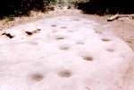
Trailhead: West Mesa or Cold Spring 7.3 on Hwy 79 Hiked up West Mesa Fire Road to West Mesa Fire Road (yes, it's a loop); 0.5 miles Climbed up to C11, a part of the CR&H trail; 2 miles Hiked across to West Mesa Fire Road; 3 miles Continued to western edge of West Mesa; 4 miles Hiked down CR&H trail to Arroy Seco Trail Camp; 4.5 miles Hiked over to morteros on side hike at Arroyo Seco, then climbed up the old road back up to West Mesa; 7 miles Hiked over to Airplane Monument; 8.5 miles Finished at Cold Spring | ||||||||||||||||||||||||||||||||||||||||||||||||||||||||||||||||||||||||||||||||||||||||
| Cold Spring - Harper Canyon
Trailhead: West Mesa or Cold Spring 7.3 on Hwy 79 Hiked down Cold Stream Trail to cut-across trail to Upper Green Valley; 1.5 miles Crossed Sweetwater Wash to get to Harper Canyon; 2.5 miles Climbed Harper Canyon, which is mostly rainbow-coloured, water-carved granite until intersecting the Harvey Moore Trail; 4 miles Climbed Harvey Moore Trail to near top, turning around at a giant fallen pine; 5.5 miles Returned by way of Harvey Moore Trail all the way to Upper Green Valley Road; 9 miles Took the road to School Camp; 9.5 miles Finished by following the Cold Stream Trail | ||||||||||||||||||||||||||||||||||||||||||||||||||||||||||||||||||||||||||||||||||||||||
| Oakzanita - Descanso
Trailhead: Oakzanita 3.3 on Hwy 79 Hiked fire road going east to Blue Ribbon Trail 1.5 miles Descended down to Merigan Fire Road 3 miles Ascended about 100 feet to start of this road at mile 1.6 of Hwy 79, then reversed course to intersection with Sweetwater trail 4 miles Followed dirt road alongside Sweetwater River to southern edge of park in Descanso 6 miles Reversed back to intersection at Merigan 8 miles Continued north on Green Valley Falls Trail to original fire road 9 miles Finished hike by following road back to trailhead
| ||||||||||||||||||||||||||||||||||||||||||||||||||||||||||||||||||||||||||||||||||||||||
| Sweetwater Bridge - Thousand Trails - Juaquapin
Trailhead: Sweetwater Bridge 4.9 on Hwy 79 Hiked to Green Valley Campground turn-off 0.5 miles NOTE: this is actually 50 yards south of entrance, and is unmarked at the road. Continued to Oakzanita trailhead 1 mile Descended to edge of park at Thousand Trails, at yet another trailhead 2 miles Climbed back up on Lower Descanso Creek Trail to East Mesa Fire Road 3 miles Turned right, and started up the fire road for about a quarter mile or so to connector trail, taking this to the Harvey Moore Trail 4 miles After a short jog on this trail, turned off to Juaquapin Creek Crossing 5 miles NOTE: there are 10 deep morteros at the junction above the creek crossing. Turned right and intersected Dyar Spring Trail 6 miles By this time, thunder showers were coming down pretty good. Descended on this trail to East Side Trail, turned left and left again on the east approach back to Joaquipin Creek Crossing 7 miles Climbed back up to this intersection, and noted that about a quarter inch of rain must have fallen, based on depth of water in morteros 8.5 miles Descended back, and turned left on short way back to trailhead 9 miles After hitting East Side Trail, and continuing west, finished at trailhead.
|
Oakzanita - Descanso Falls - Dead Horse Trail
| Trailhead: East Mesa or Oakzanita 3.7 on Hwy 79 Hiked about 0.3 miles to unmarked fireroad going into Thousand Trails area. Left park thru gate, hiked to end of trail at dirt road, hiked down to heavily used dirt road. Did about face, and hiked up to top of hill. Followed pretty good trail that eventually hit and followed park boundary. After finding an entrance gate, descended down trail that eventually merged with the Blue Ribbon Trail, which I took to Merigan fire road 3 miles Hiked west to Sweetwater River, taking road south to unmarked trail. This was a short spur that went down the the now dry river. Here I discovered a 20' high dam that was completely silted over. Continued south on road to Descanso Falls trailhead. Hiked to falls 6 miles, which are pretty neat: 40' diameter pool that might be 3' deep were there water. Falls are in 3 sections in the sculpted granite, and total about 15'. Just a really nice grotto. 6 miles Hiking back on west side of riverbed, took trail which I thought would take me back to road, but wound up being the Dead Horse Trail. This took me to the CR&H Trail, just inside park boundary. Hiked over to western edge of park, and returned to this intersection 9 miles Hiked over to South Boundary Fire Road 10 miles Finished hike by following this road to start.
|
Sweetwater Bridge - Harvey Moore - Deer Spring
| Trailhead: Sweetwater Bridge 4.9 on Hwy 79 Hiked east on East Side Trail, looping on shorter Juaquapin shortcut loop, then going north to museum, and back to East Side Trail 3 miles Continued east to Harper Canyon, and hiked up to junction with Deer Spring Trail 6 miles Hiked to SE corner of park on Deer Spring Trail to Natl. Forest 'Indian Creek Trail' and back to junction 9 miles Continued west on Harvey Moore Trail to Granite Springs Primative Camp 11 miles Finished Harvey Moore Trail back at Sweetwater Bridge.
|
Sweetwater Bridge - Airplane Monument - Arroyo Seco
| Trailhead: Sweetwater Bridge 4.9 on Hwy 79 Tried to find access to north on trails going under Sweetwater Bridge. After exploring for about 10 minutes, determined none exist, and crossing would cause wet feet. Crossed bridge, and found trail which connected with Jamacha Fire Road. Climbed on this road to junction with West Mesa Fire Road 2.2 miles Turned left, and hiked to Airplane Monument, hiking on trail missed on last hike in the area, doubled back to monument 3.7 miles Hiked down towards Green Valley Campground, took Arroyo Seco cut-off trail to Arroyo Seco Road 5.8 miles Hiked up road to Arroyo Seco Trail Camp, and side trail to morteros 7.3 miles Hiked down to junction with fire road, hiked up to first junction with Pine Ridge Trail 7.9 miles Reversed course, and hiked down road towards Green Valley Camp. At junction with previous cut-off trail, hiked down to creek where there is a half washed-away bridge, and blackberry vines. Ate a few blackberries, and continued on road down to Green Valley Camp 8.7 miles Hiked to campground entrance, and connected with connector trail back to trailhead.
|
Oakzanita - Willows - Saddleback - East Outback - Green Valley
| Trailhead: East Mesa or Oakzanita 3.7 on Hwy 79 Hiked South Boundary Fire Road to Sweetwater Trail, went south to Merigan Fire Road, and then to Willows Trailhead, passing at edge of swarm of (killer?) bees just befor this point 3 miles Hiked Willows Trail to Saddleback Trail, did spur to cover Saddleback Trail start at Merigan, and did about face, hiking up to CR&H 5 miles While hiking towards Pine Ridge Trailhead, found spur trail to a private ranch, hiked down to it 7 miles On way back up, found unmarked trail that turned out to be a fire trail, hiked to end, which turned out to be Arroyo Seco Primative Camp 9 miles Hiked back to CR&H, at start of unscheduled loop 11 miles Hiked to Southern Boundary Trail, and hiked to Green Valley campground, hiked thru campground, crossed over 79 to connection trail back to trailhead.
|
Oakzanita - East Mesa Tour - Upper Descanso
| Trailhead: East Mesa or Oakzanita 3.7 on Hwy 79 Hike ended at sunset on this day Climbed up East Mesa Fire Road past Oakzanita Trail to an unmarked trail 3.5 miles Hiked down trail a few hundred yards until it looked tenuous, and returned to fire road. Hiked on shortcut trail to Harvey Moore Trail, looped around triangular intersection (to ensure covering all trails in this area), continued on Harvey Moore to East Mesa Fire Road near Granite Springs 4.5 miles Looped back on fire road back to Oakzanita Trail 6 miles Hiked this trail to Oakzanita Peak spur trail 6.5 miles Hiked down Upper Descanso Creek Trail, seeing an awesome sunset along the way (hope pix turn out) to East Mesa Fire Road 8 miles Returned to trailhead on fire road.
|
Oakzanita - Pine Ridge - Green Valley Falls
| Trailhead: East Mesa or Oakzanita 3.7 on Hwy 79 Hiked to Green Valley Campground entrance 0.5 miles Hiked up Arroy Seco Road, taking side trip on trail that looped back to campground, only going a few hundred yards to see where it went. By the way, there are blackberry vines here, with ripe berries this time of year 1.2 miles Continued up Arroyo Seco to CR&H 2 miles Hiked up CR&H to Pine Ridge Trail, and took that along ridge and back to Green Valley Campground, where I explored the falls area 4.5 miles Hiked down fire road along Sweetwater River, crossed it 5.5 miles and finished at trailhead after hiking along South Boundary Fire Road
|
Attempt to find old scout trail parallelling Milk Ranch Road
| Trailhead: Trout Pond 10.7 on Hwy 79 Hiked up Milk Ranch Road, checking out all unmarked trails heading south. There were only 2. The first seemed to go towards the dwellings around the scout camp. The second was the edge of a primitive camp area, and the trails also seemed to head towards the dwelling 1 mile Continued hiking up the road, and spotted a trail down in the valley. When I got to the top, I took the Black Oak Trail all the way to Conejos to see if the old trail intersected along this part 2.5 miles Doubled back, but didn't find it. I think the old trail intersected at the pass, but was pretty much overgrown with ferns. Hiked up other side of Black Oak Trail for some pictures, before returning along Milk Ranch Road. There is a Trail Closed sign on scout camp entrance, so this trail which appears on old maps has been, apparently, decomissioned. I've been suffering with a blister on my little toe for past few weeks, and so my hikes are getting shorter.
|
Attempt to do any remaining trails in south
| Trailhead: Merigan Descanso, 0.9 miles off Hwy 79 on Viejas Hiked up Merigan Fire Road to Dead Horse Trail, up to Descanso Falls (for pictures) 1 mile Hiked up Dead Horse Trail to unmarked, but well trodden trail the went back down to Sweetwater River, hiked up river to intersection with dirt road in developed area 2 miles Returned back to Dead Horse Trail, explored an unmarked fire trail, but after hiking a few hundred yards, determined it was no longer maintained, returned back to Merigan Fire Road, continued up to unmarked trail down to river where there is a 15' high damn that is completly silted over, just for pictures 4.5 miles Returned on fire road
|
Fletcher Island - Paso Picacho Trails
| Trailhead: Trout Pond 10.7 on Hwy 79 Hiked over to Fletcher Island, hiked loop on west side 1 mile Going up Stonewall Mine trail, saw a fork, but this was probably mis-labeled, as trail was little used. Hiked over to Los Caballos, and down road to hwy 79 2 miles Hiked over to northern part of Paso Picacho Campground, taking fire road from group camp area 3 miles At an intersection took trail to see where it went, after seeing it went back to group camp, remembered that part for later, turned around, and hiked back to Azalea Glen Trail, hiking up to Azalea Spring 7 miles Took lower fire road to trail going back to campground, hiking down to trailhead. Hiked up another fire road to Lookout Road 8.5 miles Looped on a return trail to fire road, and hiked down to another intersection. Hiked up to end of dirt road, which dead-ended at a well, turned around and took parallel trail back to Azalea Glenn Trailhead in the campground 9 miles Continued hiking down toward group camp area, catching other trail I saved from earlier. Hiked up a few trails around the meeting campfire area, continued on road from there, and hiked the Paso Nature Trail 10 miles Retraced my path from Los Caballos, and back to trailhead.
|
Kelly Ditch and all side trails
| Trailhead: Trout Pond 10.7 on Hwy 79 hiked to over to Kelly Ditch 1.3 miles Hiked on trail to Engineer Road crossing 2.5 miles Followed a track that continued NW from intersection, but it petered out in a meadow after about 100 yards. Continued on Kelly Ditch Trail, up to the top of the fern meadow area 4.3 miles The fire road turnoff here was closed, so backtracked to trail fork 5.5 miles Continued on fire road to Engineer Road. This 100 yard snippet was the last trail in the park, that was unhiked by me this summer. Took road back to Kelly Ditch Trail 5.8 miles Retraced trail back to trailhead.
| ||||||||||||||||||||||||||||||||||||||||||||||||||||||||||||||||||||

