The Mystery of Yaqui Dome | |||
| Description | Latitude | Longitude | Elevation |
| State park boundary sign, 4.5' high | 33°10'47.1"N | 116°20'57.8"W | 1180' |
| Road fork | 33°10'47.7"N | 116°20'58.0"W | 1169' |
| Driveway fork of geodesic shed site | 33°10'47.1"N | 116°20'59.3"W | 1187' |
| Dome floor; about 16' diameter | 33°10'45.3"N | 116°21'04.6"W | 1205' |
| Abandonned disassembled wall panels of geodesic dome | 33°11'45.6"N | 116°20'53.3"W | 889' |
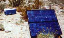
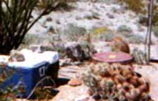
Earthquake sensor: solar photovoltaic, ~3' on a side,

10' antennae post, 1' x 2' diameter cylinder with sensors, 2 icechests with electronics. Nice vegetation: hedgehog cacti, ocotillo, barrel, beavertail.

33°9'59.9"N
| 116°21'14.1"W
| 1571'
| |
The Mystery of the Yaqui Triangle | |||
| Description | Latitude | Longitude | Elevation |
| 3.5' high metal post with cross member at 3' | 33°11'06.9"N | 116°21'22.8"W | 1050' |
| 12' tall wooden post (6' reinforced with a 4x4) | 33°11'06.7"N | 116°21'20.8"W | 1043' |
| 4' fallen high metal post with cross member, with poptop can stuck on cross member | 33°11'05.2"N | 116°21'21.2"W | 1057' |
The Mystery of the Yaqui Star Estate | |||
| Description | Latitude | Longitude | Elevation |
| Dump area of long abandonned primitive homesite | 33°11'58.2" | 116°20'37.7" | 795' |
| Probable remains of animal pen of long abandonned primitive homesite | 33°11'59.0" | 116°20'37.3" | 789' |
| Main building area, 50' diameter debris field with depression in center, of long abandonned primitive homesite | 33°12'00.3" | 20'37.4" | 790' |
| Star shapped rock entaglio near abandonned primitive homesite | 33°12'00.3" | 116°20'36.7" | 779' |
The Mystery of Eagle Perch | |||
| Description | Latitude | Longitude | Elevation |
| Only ironwood in Yaqui Meadows. 15' high, trunk 1' diameter. This is perhaps the only plant resembling a tree for miles around. Due to the ruggedness of the terraine, it could easily be missed, however. Coming upwash just before getting to this tree was an explosion of colour from brittlebush and indigo, with highlights from beavertail, ocotillo, crameria. | 33°10'43.2" | 116°22'09.4" | 1347 |
| Boulder with about 3 morteros (no deeper than an inch or 2). | 33°10'18.3" | 116°22'15.5" | |
| Adjacent boulder with about 6 morteros (no deeper than an inch or 2). | 33°10'18.9" | 116°22'15.2" | |
| Single foot mortero on a 4' or so diameter light-colored boulder. A foot mortero is one that has a rock to sit on, just above the mortero, so you could grind with your feet. | 33°10'18.2" | 22'14.9" | |
| Single foot mortero on a 5' or so diameter salt and pepper granite boulder. | 33°10'17.2" | 116°22'15.3" | |
| Dual deep metates on a split rock. One is about 1' diameter, the other about half again as big. | 33°10'16.7" | 116°22'15.1" | 1626 |
| Possible 1" deep mortero on a dark orange, smooth rock. | 33°10'16.7" | 116°22'14.7" | |
 | 33°10'13.4" | 116°22'16.5" | 1830' |
| 15' drop-off; smooth granite; 30' vertical granite cliffs on W of this deep section of wash | 33°10'19.0" | 116°22'14.3" | |
The Mystery of LC Peak | |||
| Description | Latitude | Longitude | Elevation |
| Peak LC, rock monument 3' high; at base is shelter for cammy the chameleon guarding the sacred bone of LC; under the 2' cholla, Blinky the black-nosed snake, is coiled and ready to strike (checked on 3/10/02, and found binky lost his head!). | 33°10'49.7" | 116°21'24.4" | 1342' |
The Mystery of Jef's 1979 Intaglio | |||
| Description | Latitude | Longitude | Elevation |
| Intaglio | 33°11.058' | 116°21.560' | 1173' |