|
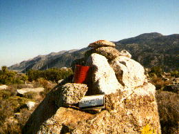
| Pinyon Mountain register at the summit, looking towards Whale Peak. |
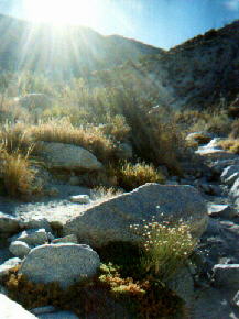
| A quarter mile down-wash from Blue Spring in Bighorn Canyon, about 1.2 hours into hike. This is taken late in the day on an earlier short 6 mile hike that hit Blue Spring, and then went through unusual rock formations where I found beehive fragments, and crossed over to Nolina Wash, and went back to car. |
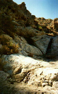
| Blue Spring. Most of water is trapped and placed in a sheep guzzler tank, but a little runoff is seen here. Blue Spring is the only spring in the entire Vallecitos range! This is 1.5 hours into hike. |
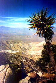
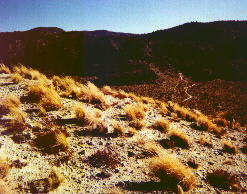
| The ridge above Blue Spring is uncharacteristically easy, altho steep. This view is most of the way up Pinyon Mountain. |
| Pinyon Mountain Pass viewed from partway down Pinyon Mountain, while descending to Pinyon Mountain Road. |
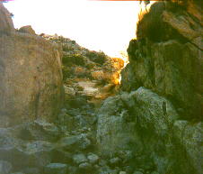
| One mile east of Pinyon Mountain Pass, the road passes thru a narrow, rugged slot in a granitic deposit. This is scarcely 6' wide, and drops a few feet. It is called Fat Man's Misery, but was no problem to me, because I was walking, and dieting. The view is looking west toward the pass (uphill). |
Starting at the confluence of Nolina Wash and Pinyon Washes, I tracked across to Bighorn Wash, ascended to Blue Spring, took the left ridge up to Pinyon Mountain, and signed the register. I descended down to the pass and took Pinyon Mountain Road through Fat Man's Misery and continued off the road, by staying in the wash, descending over several dry waterfalls. I reached Harper Valley, and continued down Pinyon Wash all the way to the start. This took most of the day, or 8 hours, and covered about 15 miles. It was a worthy hike. I reached the car at dusk. |